One platform for floating wind engineering from seabed to turbine
Stop hunting data across disconnected tools. Morie Platform combines environmental datasets,
geotechnical profiles, and engineering calculations in a single collaborative workspace —
so your team spends less time collating data and more time iterating designs.
Built by offshore wind engineers, for offshore wind engineers.
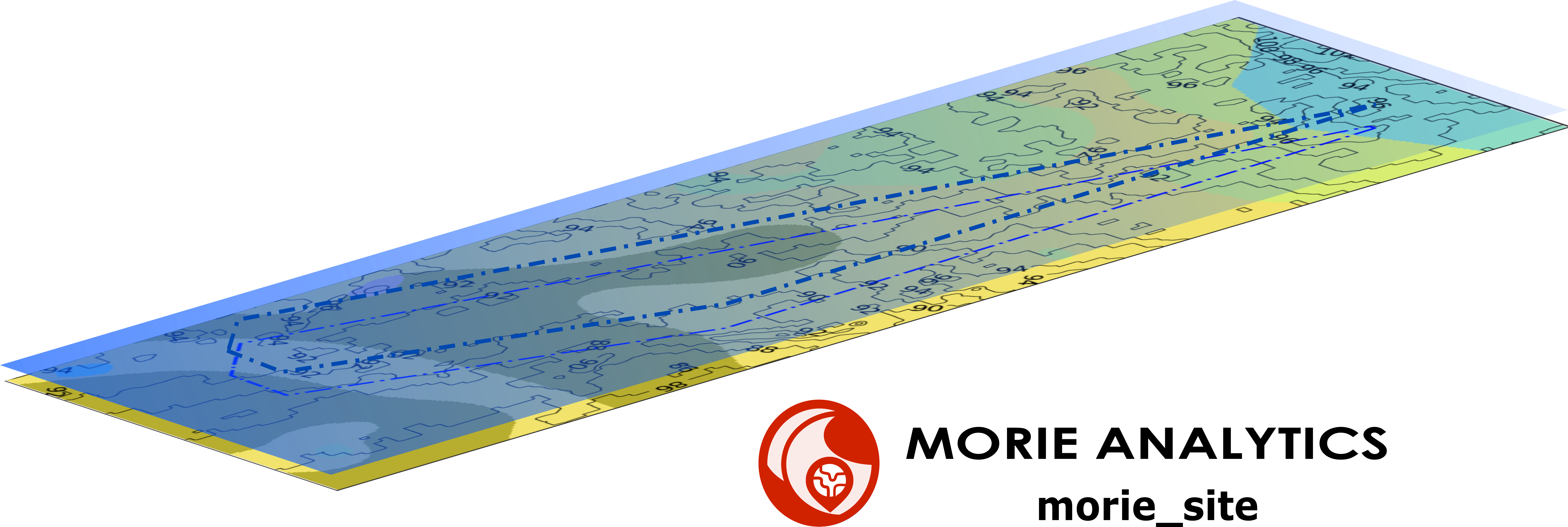
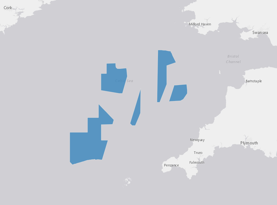
Draw your site polygon on an interactive map and let the platform do the heavy lifting.
No data downloads. No manual preprocessing. The Site Tool automatically extracts and
harmonises the environmental data your workflow depends on.
Interactive polygon drawing for project boundary definition
Automatic bathymetry extraction at configurable grid resolution (10–200 cells)
Environmental data pull from validated public marine sources
Named studies per project — iterate without losing previous runs
Anchor Tool
Main anchor concepts. Location based soil profiles. Real-time 3D geometry.
Configure main anchor concept, build a multi-layer soil profile at relevant anchor location and get capacity results —
all within your project workspace. The 3D viewer updates in real time as you adjust geometry inputs,
so you see the design change before you run the analysis.
Main anchor types: suction, torpedo, helical, driven, drilled and grouted piles as well as DEA, SEPLA, DEPLA and VLA plates
Multi-layer soil profile builder — clay, sand and rock
3D anchor geometry viewer that updates in real time
Horizontal and vertical load input with acceptance criteria
Multiple studies per project for parametric design iteration
In development
Five more tools on the way
The full engineering pipeline is being built module by module. Here's what's coming next.
Layout
Optimised turbine placement within site constraints and environmental loading.
Soil
Multi-layer geotechnical model builder and spatial interpolation across the farm footprint.
Mooring
Catenary and taut-leg mooring analysis with shared-anchor configurations.
Cable
Dynamic cable design and optimization. Inter-array and export cable routing and sizing.
Run site assessments, anchor studies, and mooring analyses directly
from Python — in your scripts, Jupyter notebooks, or automated pipelines.
Full OrcaFlex interoperability included.
$pip install morie
Submit and poll engineering jobs from Python
Export mooring designs directly into OrcaFlex
Import OrcaFlex loads back into anchor capacity studies
import OrcFxAPI
import morie
import morie.orcaflex # activates OrcaFlex integrationwith morie.Client(api_key="mk_live_...") as client:
project = client.projects.get("your-project-id")
# open a Morie mooring design in OrcaFlex (Windows)
project.mooring.export_to_orcaflex(mooring_job_id)
# load a completed OrcaFlex simulation
model = OrcFxAPI.Model()
model.LoadSimulation("storm_uls.sim")
# extract Line1 anchor loads → run capacity study
job_id = project.anchor.run_from_orcaflex(
model,
line_name="Line1",
anchor_payload={
"anchor_type": "suction_pile",
"geometry": {"D": 5.0, "L": 10.0, "zlug": 8.0},
"soil": {"soil_type": "clay", "profile": [...]},
},
name="North Sea — OrcaFlex ULS loads",
)
job = client.jobs.wait(job_id)
print(job.result_payload)
Built for teams
Work together, not in parallel
Morie Platform is organised around projects. Each project holds multiple studies per tool,
so your team can run design iterations without overwriting each other's work.
Project workspaces
Group all tools and studies under a single project. Share context across Site, Anchor, and future tools without re-entering data.
Role-based access
Assign Viewer, Editor, or Owner roles per project. Keep sensitive studies locked down while sharing results freely.
Organisation plans
Manage your whole team under one organisation account. Custom subdomains (yourorg.morie.io) keep your workspace identifiable.
Multiple studies per tool
Run parametric variants within the same project. Compare results across design iterations without duplicating setup work.
Early access
Join the engineers shaping floating wind
Morie Platform is available by invitation only. We are working with a select group of
offshore wind engineers, consultancies, developers and classification societies to
refine the tools before broader release.
Site Tool — interactive boundary definition and bathymetry extraction
Anchor Tool — Main anchor types, multi-layer soil profiles, 3D geometry viewer
New tools as they are released (Layout, Soil, Mooring, Cable, Atlas)